Showing posts with label Bonga Field. Show all posts

Friday, December 23, 2011

Shell Oil Spill - Moving Toward Nigerian Coast

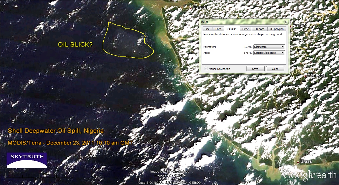
Yesterday's MODIS satellite images were a bust, but today's were slightly less cloudy/hazy.  Both the Terra and Aqua images show a pale patch of ocean water about 18 kilometers offshore, covering a total area of about 678 square kilometers.  But this is a tough call - the image quality really isn't very good.  The closest sizable populated area near this part of the coast, according to Google Earth, is the town of Burutu located at top center on this graphic:
MODIS/Terra satellite image taken December 23, 2011 at 10:10am local time. Possible location of oil slick noted. Image data courtesy NASA/MODIS Rapid Response Team.
This fuzzy patch that may or may not be the remnants of the oil slick is located about where we would expect to see it, given the wind speed and direction over the past couple of days (blowing from the south-southwest at 5-10 knots). Radar imagery would give us a better look but we haven't seen any new radar images since December 21.

[[Location:4.554,4.618]]

Wednesday, December 21, 2011

Shell reports Up to 1.7 MIllion Gallon Oil Spill in off Nigerian Coast

Envisat ASAR satellite radar image showing large slick (outlined in yellow) from major oil spill off Niger Delta.  Image courtesy European Space Agency.
Royal Dutch Shell's Nigerian drilling operations in the highly productive Bonga Field were officially brought to a halt yesterday after "less than 40,000 barrels of oil" (1.7 million gallons) were reportedly leaked during a transfer of crude to a tanker. We've just processed a radar satellite image taken this morning (December 21, 2011) of the field, with the spill clearly visible.  Here it is showing the slick outlined in yellow; it is about 70 km (45 miles) long, 17 km (10 miles) wide at it's widest, and covers 923 square kilometers (356 square miles) of ocean: 

Another, much smaller oil slick appears at lower right; this looks like a bilge dump from a passing vessel, not related to the Shell spill.


[[Location:4.554,4.618]]