Every now and then we see something in
SkyTruth Alerts
that catches our eye. For the past few days we've noticed repeated
reports of an unknown oil slick sighted near some platforms near Block
321 in the East Cameron (South Addition) area of the central Gulf of
Mexico, about 92 miles off the Louisiana coast. We also see two slicks
in the vicinity on an Envisat ASAR satellite radar image taken about
noon local time on March 14. The slicks aren't particularly big, on the
image or in the reports, but their persistence in the area under
strong winds blowing steadily from the southeast
suggests that there is a continuous source of oil leaking at this
site. This is close to a major international shipping lane for the port
of Houston, and there are also quite a few platforms and pipelines in
the neighborhood:
 |
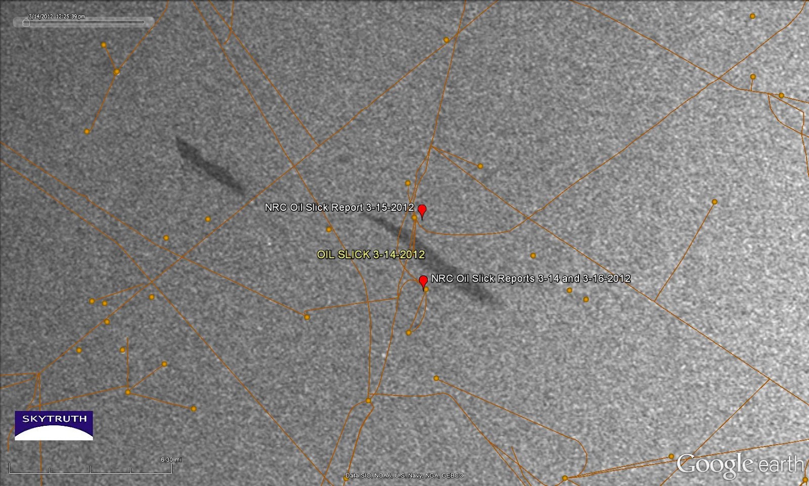
| Radar
satellite image taken March 14, 2012 showing a pair of small slicks
near the vicinity of oil slick sightings reported to the National
Response Center on March 14, 15 and 16 (red markers). Orange lines and dots are pipelines and platforms. Image courtesy
European Space Agency. |
The water depth here is about 200-300 feet (note that a pipeline in this area was damaged during drilling operations
back in 1978). Oil slick sightings were reported to the National Response Center, probably by personnel on the nearby platforms, on March
14,
15 and
16. No source or cause is indicated in the reports. We don't know if there is any active drilling occurring in the area.
If anybody wants to
swing on by and take a look, the center of the slick at right is located
at 28.197404° North latitude / 92.783588° West longitude.
[[Location:28.197404,-92.783588]]